
Caroline Furnace Lutheran Camp, the start/finish of the MMT 100, flanked by the East and West ridges of the Massanuttens.
Keith Knipling
The Course
MMT offers 100 mile and 100 km trail ultras on the rocky, demanding trails of Virginia’s Massanutten Mountains. Short but rugged climbs add up to more than 18,500 feet on the 100 mile course and 11,250 feet on the 100 km.
100 mile distance
- Distance
-
- 100.6 mi
- Ascent/descent
-
- 18,500 feet
- Aid stations
-
- 15 aid stations
- 8 with crew access, 10 with dropbags
- Time cutoff
-
- 36 hours
- GPX file
Course map
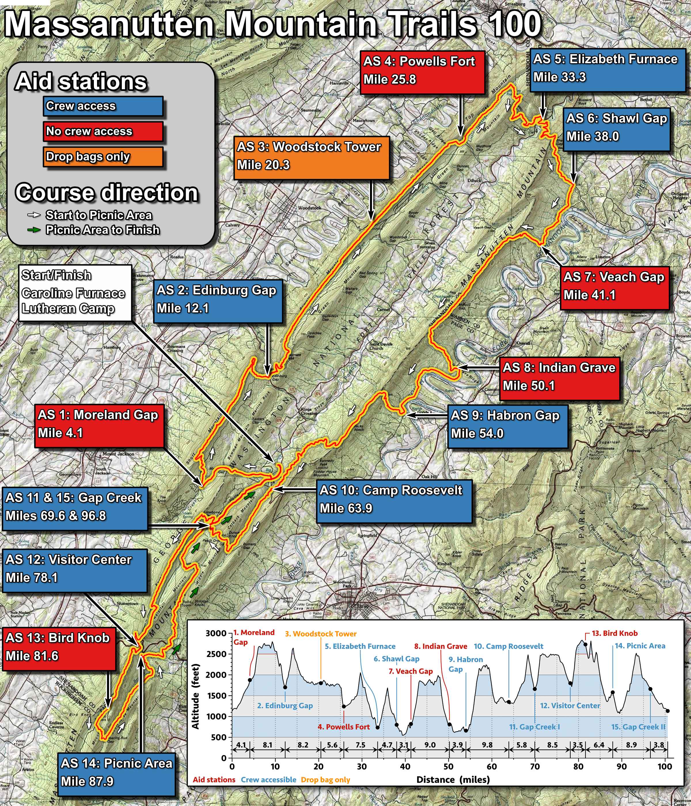
The course is best pictured as two “almost loops” along the ridges of the Massanutten Mountains, forming a top-heavy figure-8. Pins on the map mark the aid stations, color-coded by crew access: Crew access; No crew access; Drop bag only.
The first loop starts at Caroline Furnace Lutheran Camp. After a short stretch west on dirt road, the course runs clockwise, north along the western ridge of the Massanuttens to Elizabeth Furnace (Aid Station 5, mile 33.3). It then climbs to the eastern ridge and follows it south to Gap Creek I (Aid Station 11, mile 69.6), dropping off the ridge periodically to reach the aid stations.
The second, smaller loop begins at Gap Creek I and runs counter-clockwise along Kern’s Mountain south to Bird Knob, then back north to Gap Creek II (Aid Station 15, mile 96.8).
A printable map of the course is shown below and is also available as a two-page PDF for printing (2.4 MB download).
Elevation profile
The course has roughly 10 climbs of 750 vertical feet or more. None is especially long, but many are steep, and a rocky ridgeline waits at the top. The course is tougher than it looks on paper.
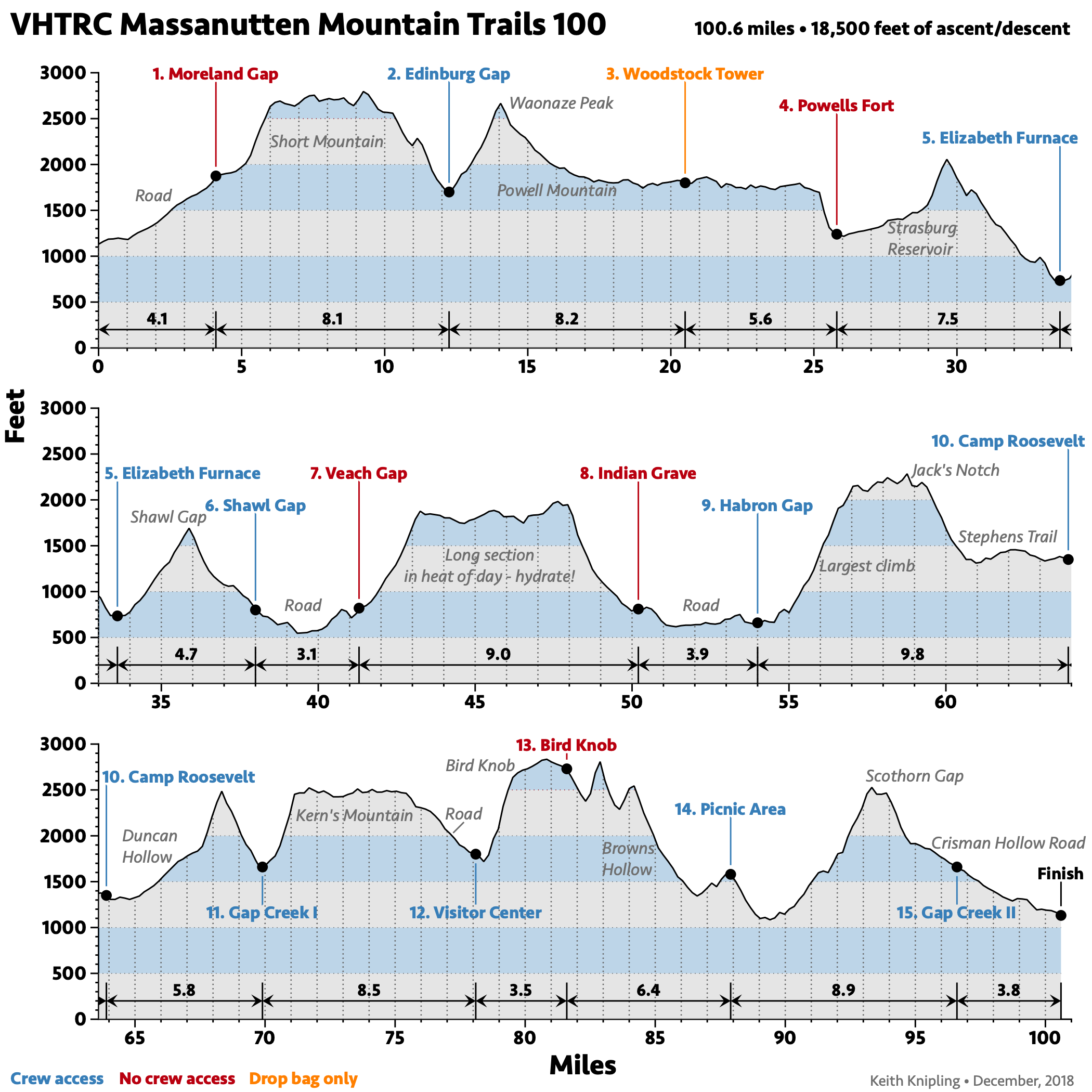
The high point is 2,835 feet (Bird Knob, mile 81); the low point is 540 feet (mile 39, between Shawl Gap and Veach Gap). The longest single climb, 1,550 feet in 2.5 miles, comes at mile 55, just after the Habron Gap aid station.
Aid stations
The 100 mile has 15 aid stations, 9 of them crew-accessible. The table below lists each station’s mileage, crew and drop bag access, and cutoff.
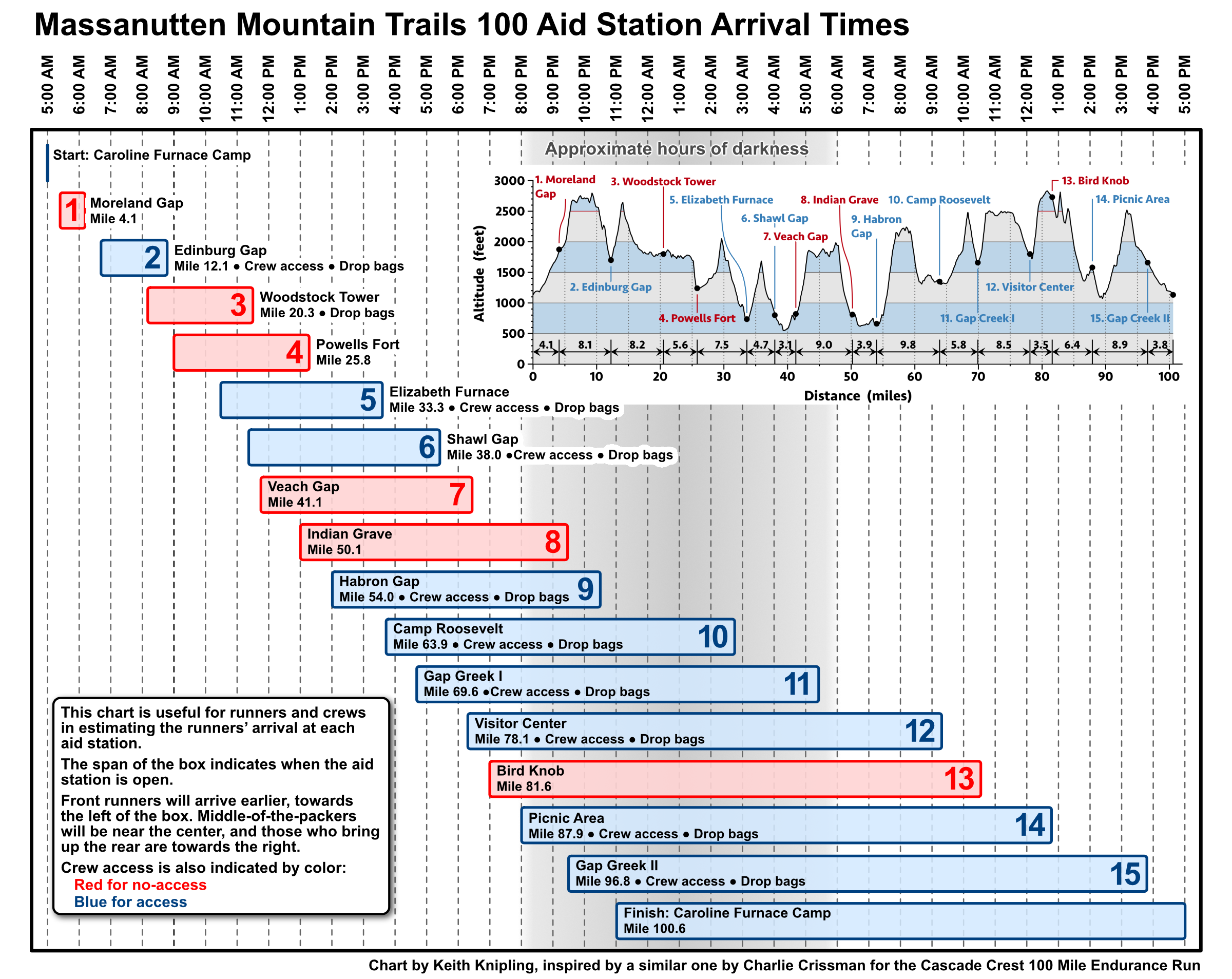
The chart below helps runners and crews estimate arrival times at each aid station. Download a printable PDF (1.4 MB download).
Course markings
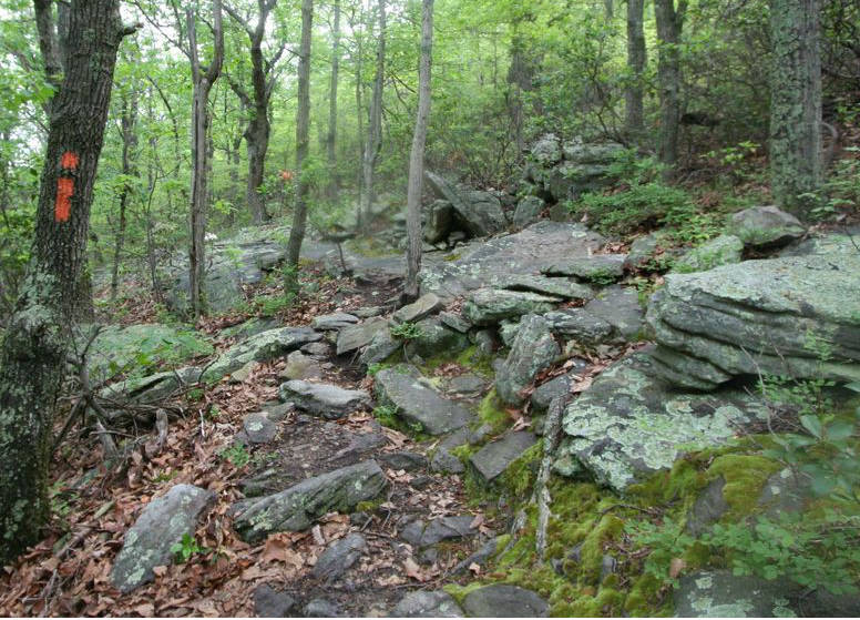
The course is marked with yellow surveyor’s tape, with reflective markers on the sections run at night. Red tape bars trails you should not take; never cross a red ribbon. The VHTRC has a reputation for a well-marked course, but you can still get lost if you don’t pay attention.
Weather
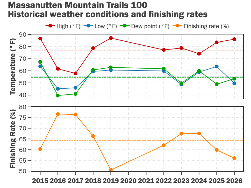
The May date usually spares runners Virginia’s summer heat, but some years have been hot, with correspondingly low finishing rates, and others cool, with highs failing to reach 60 °F. Typical daytime highs are in the 70s (°F), and the coldest parts of the course can dip into the 40s. Temperatures rarely fall below freezing, but the ridges can get chilly, especially for slower runners late in the race. It often rains at some point during the weekend, and past years have brought torrential rain and violent storms.
Read the local weather forecast.
PATC maps
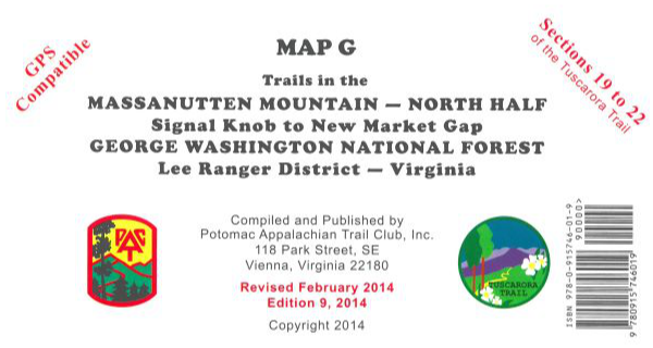
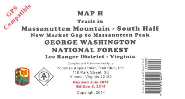
Unless you know the course well, we recommend Potomac Appalachian Trail Club (PATC) maps G and H. These topographic maps cover the Massanutten trails north of US 211 (Map G) and south of US 211 (Map H), printed in six colors on water- and tear-resistant synthetic stock. Most of the course is on Map G; only the Bird Knob section is on Map H. PATC also publishes the Guide to the Massanutten Mountains (updated 2013), sold on its own or as a set with both maps. PATC members receive a discount.
You can order the maps from the PATC website.
Map G is also available at REI.
100 km distance
- Distance
-
- 65.2 mi
- Ascent/descent
-
- 11,250 feet
- Aid stations
-
- 10 aid stations
- 5 with crew access, 6 with dropbags
- Time cutoff
-
- 22 hours 30 minutes
- GPX file
Course
The 100 km course is a single loop along the Massanutten ridges that encircle Fort Valley. From the start at Caroline Furnace Lutheran Camp, it follows the 100 mile course north along the western ridge to Elizabeth Furnace (Aid Station 5, mile 33.3), then south along the eastern ridge to Camp Roosevelt (Aid Station 10, mile 63.9), before returning to Caroline Furnace to finish.
See the 100 mile course description for the course map, elevation profile, course markings, weather, and PATC maps.
Aid stations
The 100 km has 10 aid stations, half of them crew-accessible. The table below lists each station’s mileage, crew and drop bag access, and cutoff.